Picturesque Mountain Peaks
Hiking
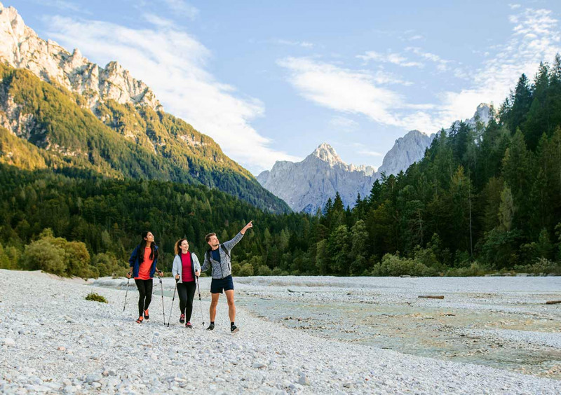
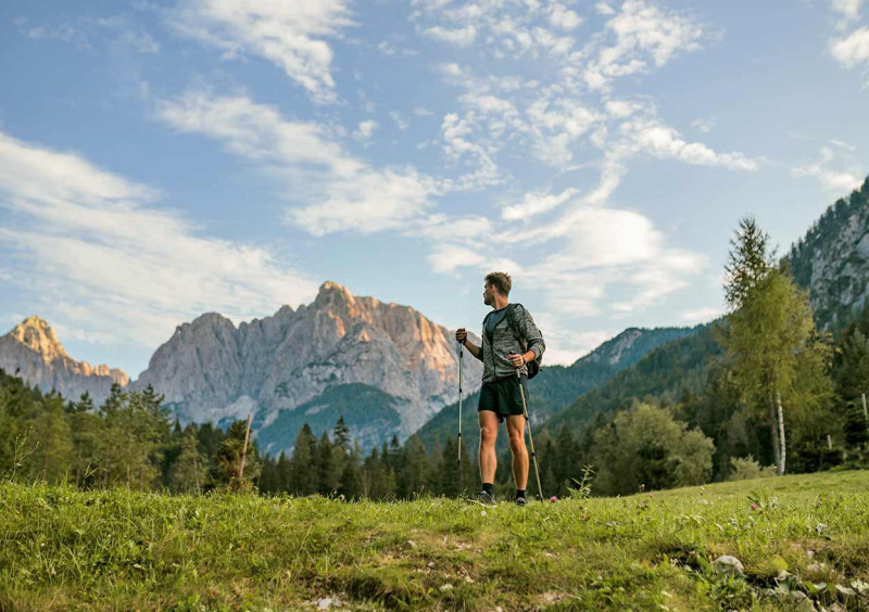
Kranjska Gora is surrounded by the picturesque peaks of the Julian Alps and is a real paradise for hikers. Unspoiled nature invites you along its paths where you can discover new stunning views with every new step.
Discover the nature
Exploring outdoors
Put on your hiking boots and feel the path under your feet. Where to? There are countless trails, and they will all reward you with exceptional views. You can find ideas for a hike on this page, with our friendly colleagues at the reception, or in the tourist information centers in Kranjska Gora, Mojstrana and Rateče, where, in addition to good advice, you can also get a trail map of the Upper Sava Valley. Go higher, you will realize that the world is much more beautiful when you change perspective.
Sources:
http://www.mojstrana.com/sl/#
https://kranjska-gora.si/
https://www.hribi.net/
![]()
HIKING SUGGESTIONS
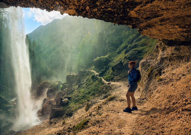
The trail starts from the pillar in front of the Tourist Office in Kranjska Gora. The path leads you through the village center, past the Hotel Razor (the first hotel in Kranjska Gora, built-in 1902), across the Na Gorici Square, and past the late-Gothic church of the Assumption. Turn right at the restaurant Cvitar and continue towards the casino Korona. Cross the Vršič street (Vršiška ulica) and then the Pišnica river. On the right side of the casino, go straight onto a steep but nice path towards Drčev rut (the Drč clearing). Further on, the trail broadens and brings you to the holiday camp Jasna. Follow the signposts and take the wider trail towards the east – to Gozd Martuljek. After approximately one hour of walking you meet a junction with a sled track in Gozd Martuljek. You can decide whether to descend along the sled track (the forest road) to Gozd Martuljek or continue on trail no. 6 towards Martuljek Waterfalls, an astonishing natural monument. It had been protected for more than 30 years before it was included in the Triglav National Park. Cross Tofov graben (the Tof streambed) between Jasna and Gozd Martuljek. Although the path is pleasant to walk on, you can expect a more demanding part of the trail due to constant erosion.
The difficulty of the route: 2
We are suggesting appropriate equipment and good physical condition.
Starting point: Kranjska Gora (810 ASL)
Midpoint: Tofov graben (975 ASL)
Finish: Bus station Gozd Martuljek (744 ASL)
Distance: 8.000 m
The trail starts from the pillar in front of the Tourist Office in Kranjska Gora. The path leads you through the center, past the Hotel Razor (the first hotel in Kranjska Gora, built-in 1902), across the Na Gorici square, and past the late-Gothic church of the Assumption. Turn left at the Hotel Kotnik towards the Pension Lipa. Turn right at the first junction (next to the pension) and continue to the bus station. The path continues onto the main road Jesenice – Rateče on the right side of the apartment building behind the bus station. Cross the main road and the Sava River. Turn right and continue uphill towards Galerše (the Galerše pasture) and past the hut. The path goes past a snack bar. You will notice a narrow, steep trail behind the paddock at the end of the wide path. Continue onto this trail through the woods, crossing several brooks, towards the first farmhouse (Pri Merkeljnu) in Srednji Vrh. Descend on the asphalt road into Gozd Martuljek.
The difficulty of the route: 2
We are suggesting appropriate equipment and good physical condition.
Starting point: Kranjska Gora (810 ASL)
Midpoint 1: Robe (ASL)
Midpoint 2: Srednji vrh – Farmhouse Smolej (965 ASL)
Finish: Bus station Gozd Martuljek (744 ASL)
Distance: 11.000 m
The trail starts from the pillar in front of the Tourist Office in Kranjska Gora. The path leads you through the center, past the hotel Razor (the first hotel in Kranjska Gora, built-in 1902), across the Na Gorici Square, and past the late-Gothic church of the Assumption. Turn left at the Hotel Kotnik towards the pension Lipa. Turn right at the first junction (next to the pension) and continue to the bus station. The path continues onto the main road Jesenice-Rateče on the right side of the apartment building behind the bus station. Cross the main road and the Sava River and turn left. Head along the Sava river, then turn in the woods towards the hill. Turn left at both forks in the route. When you descend slightly and come out of the woods, continue straight forward (if you turn left you will come to the main road).
We arrive at the first houses in Podkoren; you walk approximately 200 meters on the asphalt road. Then turn on the path, running parallel to the road to the Korensko Sedlo pass. Turn left through the underpass and after several 100 meters you arrive at the beautiful village center. In Podkoren you can also see the ski slope where the Men´s World Cup slalom and Giant Slalom Competition (Vitranc Cup) takes place and a commemorative plaque dedicated to prominent natural scientist and inventor Sir Humphry Davy.
The difficulty of the route: 1
Starting point: Kranjska Gora (810 ASL)
Midpoint: Junction towards Robe (825 ASL)
Finish: Podkoren – under the lime tree (853 ASL)
Distance: 3.600 m
The trail starts from the pillar in front of the Tourist Office in Kranjska Gora. The path leads you through the center, past the hotel Razor (the first hotel in Kranjska Gora, built-in 1902), across the Na Gorici Square, and past the late-Gothic church of the Assumption. Turn left at the Hotel Kotnik towards the pension Lipa. Turn right at the first junction (next to the pension) and continue to the bus station. The path continues onto the main road Jesenice-Rateče on the right side of the apartment building behind the bus station. Cross the main road and the Sava River and head straight onto a wide unpaved route. It leads beneath the cliffs (Peči) and across meadows (Stan) towards Podkoren.
Before crossing a dry streambed you can see a wooden hut on the right. Continue along the dry streambed and past the wooden hut. The trail ascends and joins a forest path. Turn left, then cross the Suhelj Brook and continue to the road leading to the Korensko Sedlo Pass. Cross the road as well and descend into Podkoren onto the old asphalt road leading to the village, continuing to its center. In Podkoren you can also see the ski slope where the Man´s World Cup Slalom and Giant Slalom Competition (Vitranc Cup) take place and a commemorative plaque dedicated to prominent natural scientist and inventor Humphry Davy
The difficulty of the route: 1
Starting point: Kranjska Gora (810 ASL)
Midpoint: Road to Korensko sedlo (922 ASL)
Finish: Podkoren – under the lime tree (853 ASL)
Distance: 4.000 m
The trail starts from the pillar in front of the Tourist Office in Kranjska Gora. The path leads you through the center, past the Hotel Razor (the first hotel in Kranjska Gora, built-in 1902), across the Na Gorici Square, and past the late-Gothic church of the Assumption. Turn left at the Hotel Kotnik towards the pension Lipa. Turn right at the first junction (next to the pension) and continue to the bus station. The path continues onto the main road Jesenice-Rateče on the right side of the apartment building behind the bus station. Cross the main road and the Sava River.
Turn right and head along the Sava river past the sports park. Before arriving at the bridge over the Sava River head straight forward along the river on a narrow path toward Gozd Martuljek. After Approximately 4 kilometers cross the Sava bridge and continue up to the first asphalt road. You have several options now. You can either turn right, cross the main road Jesenice – Rateče, take a lane, and head for trail no. 6; you can turn left instead (you will arrive at the bus station); or you can turn left, cross the bridge across the Sava river and return to the Hotel Špik on the unpaved route.
The difficulty of the route: 1
Starting point: Kranjska Gora (810 ASL)
Midpoint: Junction towards Srednji vrh (767 ASL)
Finish: Bus station Gozd Martuljek (744 ASL)
Distance: 5.200 m
The trail starts from the parking lot at the former pension Špik in Gozd Martuljek. Take the cycling track, then a forest path towards a charcoal pile and the gorge of the Martuljek brook. Turn left before the path starts ascending to get to the gorge.
You can admire the idyllic gorge while crossing footbridges over Martuljek Brook. You reach the beautiful First Martuljek Waterfall. In the first part, the trail ascends and joins a wider forest path. Turn left uphill and shortly after you reach Jasenje (the Jasenje posture).
You can continue onto the marked hiking trail towards Second Martuljek Waterfall. When returning past Jasenje, you can take the forest path toward the valley instead of turning right into the gorge. However, the path is rather steep somewhere. At the charcoal pile, take the first path. The gorge (and the area) is an outstanding natural monument that has been protected for more than 30 years before it was included in the Triglav National Park.
The difficulty of the route: 83
Good walking shoes, a helmet, and good physical condition are recommended.
Starting point 1: Avtobusna po Gozd Martuljek (744 ASL)
Starting point 2: Pension Špik Gozd Martuljek (744 ASL)
Midpoint: First Martuljek waterfall (837 ASL)
Finish: Chappel Jasenje (924 ASL)
Distance: 3.000 m
The trail starts from the pillar in front of the Tourist Office in Kranjska Gora. Take Tičar street (Tičarjeva ulica) and head towards the Hotel Best Western. Turn right at the end of the parking lot behind the hotel, pass the tennis courts and continue towards the forest path, which later joins a trail crossing the slope. Turn left and continue towards Lake Jasna onto the path running parallel to the road to Vršič Pass. Go past Lake Jasna and the Mala Pišnica Valley.
Continue onto the forest path which steeply ascends after it crosses the Pišnica River. The path continues under the power supply line towards the former Pension Erika. When arriving at Erika take trails crossing pastures and leading through the wood. Once or twice you return onto the road leading up to the Vršič pass, but shortly after you go into the woods again. Shortcuts lead you onto the old Russian road (Ruska Cesta) towards the Mihov dom (mountain hut) and past the Russian chapel.
Cross the road and return onto it at the 17th hairpin bend. Turn left from the road and descend to the Stari Tamar pasture. After approximately 200 meters, the path turns right and returns onto the old Russian road; it passes Erjavčeva koča, Poštarski dom, and Tičarjev dom (mountain huts) and ascends to the Vršič pass, the highest mountain pass in the eastern Julian Alps.
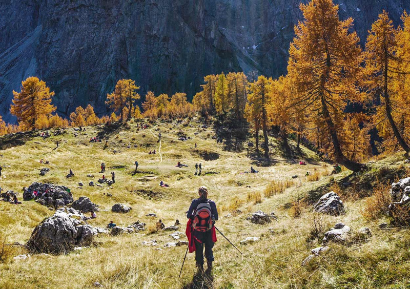
Along the way, you can see numerous natural monuments and examples of cultural heritage, such as Ajdovska Deklica (an image of a female face in the mountain wall of Prisank), the Prisank Window (an opening in the rock of Prisank), the Russian Chapel and the burial ground where the bodies of the Russian prisoners of war (who built the road) are buried. We recommend good walking shoes.
The difficulty of the route: 3
Starting point: Kranjska Gora (810 ASL)
Midpoint 1: Junction at the bridge at Erika (869 ASL)
Midpoint 2: Russian chapel (1.158 ASL)
Midpoint 3: Stari Tamar (1.390 ASL)
Finish: The Vršič pass (1.611
Distance: 12.700 m
The trail starts from the pillar in front of the Tourist Office in Kranjska Gora. Take Tičar street (Tičarjeva ulica) and head towards the Hotel Best Western. Continue onto the road, leading to the Vršič pass, towards lake Jasna and the former Pension Erika. Turn left before the bridge at Erika and head along the Pišnica river towards the hut in the Krnica valley. When returning you have two possibilities; you can either return on the same path or you can turn left (leading uphill) in the Mali Tamar valley, towards the road to the Vršič pass and the Mihov dom mountain hut. In the Mali Tamar valley, you can see a memorial to mountaineers who died in the mountains.
The difficulty of the route: 2
Good walking shoes and good physical condition are recommended.
Starting point: Kranjska Gora (810 ASL)
Midpoint: Junction at the bridge at Erika (869 ASL)
Finish: Hut in Krnica (1.124 ASL)
Distance: 6.900 m
From the parking lot in Planica, the route begins on an unpaved road, which leads us to the intersection of two roads. We continue along the upper road on the left, which climbs moderately and goes partly through the forest and partly over scenic slopes. Higher up, the path through Grlo branches off to the left (the aforementioned path leads to Slemenova špica, Mala Mojstrovka, and Vršič), and we continue straight and follow the road to its end at the mountain lodge in Tamar.
The mountain lodge can also be reached by a parallel mountain trail, but it is worth noting that it is closed in winter because of the cross-country trail.
The difficulty of the route: 1
Starting point: Nordic Center Planica (931 ASL)
Finish: Cottage in Tamar (1.108 ASL)
Distance: 3.700 m
The trail starts at the pillar Tourist Office in Kranjska Gora. The path leads you through the center, past the Hotel Razor (the first hotel in Kranjska Gora, built-in 1902), across the Na Gorici Square, and past the late-Gothic Church of the Assumption. Turn left at the Hotel Kotnik towards the Pension Lipa. Turn right at the first junction (next to the pension) and continue to the bus station. The path continues onto the main road Jesenice-Rateče on the right side of the apartment building behind the bus station. Cross the main road and the Sava River and continue straight onto a wide unpaved road. After several 100 meters of walking you come across a fork in the route. Turn left on a steep and narrow path, and ascend over Peči (the Peči cliffs) affording superb views. Continue towards the junction with trail No 3. You can either continue towards Podkoren and Kranjska Gora, or you can take trail no. 3. If you choose the second option, turn left after approximately 500 meters, cross the Sava River and the main road, and take the cycling track and return to Kranjska Gora.
The difficulty of the route: 2
Good walking shoes and good physical condition are recommended.
Starting point: Kranjska Gora (810 ASL)
Midpoint: Junctions towards Brda (meadow) (825 ASL)
Finish: Kranjska Gora (810 ASL)
Distance: 3.400 m
The trail starts from the pillar at the bus station in Rateče. Head towards the south, cross the main road and continue towards the Planica Valley. You can either walk on the asphalt road or you can take the cycling track that leads toward Podkoren. After several 100 meters turn right onto a nice path and later join trail no. 9. In Planica you can see two ski jumps where a man jumped over 100 meters for the first time and the biggest ski-flying hill in the world where the 200 m mark was reached as well.
The difficulty of the route: 1
Starting point: Bus station Rateče (862 ASL)
Midpoint: Planica (941 ASL)
Finish: Bus station Rateče (862 ASL)
Distance: 4.900 m
The trail starts from the pillar at the bus station in Rateče. Head through the village towards the east, cross the main road, and go to a parking lot. From there it should take 10 minutes to reach Zelenci, a source of the Sava River. When returning, you can head towards Podkoren; after several 100 meters across the Sava River, passing the chairlift, return to Rateče on the cycling track. An area called Zelenci is a nature reserve where a few rare and indigenous plant and animal species live.
The area was researched by Sir Humphry Davy a renowned natural scientist and inventor. A special feature of Zelenci is the constant water temperature, varying between 5 and 6 degrees Celsius irrespective of air temperature.
The difficulty of the route: 1
Starting point: Bus station Rateče (862 ASL)
Midpoint: Outlook tower in Zelenci (837 ASL)
Finish: Bus station Rateče (862 ASL)
Distance: 3.400 m
The trail starts from the pillar in front of the Tourist Office in Kranjska Gora. Take the Borovška Street (Borovška cesta) past the Hotel Larix and the Hotel Kompas and continue towards the lower station of the chairlift Vitranc 1. Take the chairlift to arrive at the lower station of the chairlift Vitranc 2 and ascend to Vitranc. Go westward along the ridge; after approximately a 45-minute walk you arrive at the peak of Ciprnik.
The difficulty of the route: 3
Good walking shoes and good physical condition are recommended.
Starting point: Kranjska Gora (810 ASL)
Midpoint 1: Spodnja postaja Vitranc 1 (1.117 ASL)
Midpoint 2: Zgornja postaja Vitranc 2 (1.564 ASL)
Finish: Ciprnik (1.749 ASL)
Distance walking: 2.700 m (only walking)
Distance walking and chairlift: 4.500 m (walking and chairlift)
The trail starts from the pillar in front of the tourist Office in Mojstrana. Cross the bridge over the Triglavska Bistrica River and take the road leading to the Vrata Valley. On the left, you can see the Viharnik garden and later the Triglav Museum collection.
Before the road starts ascending (opposite apartment buildings) turn right on a trail; keep to the right throughout the walk. When you arrive at the Grančišče Hill, your effort is certainly repaid-you can enjoy a spectacular view.
The difficulty of the route: 2
Good walking shoes and good physical condition are recommended.
Starting point: Mojstrana (644 ASL)
Midpoint: Grančišče (844 ASL)
Finish: Mojstrana (644 ASL)
Distance: 4.000 m
The trail starts at the pillar in front of the Tourist Office in Mojstrana. Head along the Triglavska Bistrica river and pass the holiday farm Pr' Železn'k. the asphalt road turns into an unpaved road and narrows. Shortly afterward you turn left up a narrow path and soon you arrive at beautiful lake Kreda. You can return either on the same track or you can head left towards the farmhouse Ros and take the stage road leading past the Triglav museum collection, which is also a part of trail no. 16.
The difficulty of the route: 2
Good walking shoes and good physical condition are recommended.
Starting point: Mojstrana (644 ASL)
Midpoint: Kreda (706 ASL)
Finish: Mojstrana (644 ASL)
Distance: 4.500 m
The trail starts at the pillar in front of the Tourist office in Mojstrana. Head along the Triglavska Bistrica River past the holiday farm Pr'Železn'k. The asphalt road turns into an unpaved route and narrows. Continue towards the farmhouse Ros. There you can either take an unpaved state road leading towards the Vrata valley or you can walk on the right bank of the Triglavska Bistrica river. After several kilometers, you arrive at the 52-meter-high waterfall Peričnik.
You can see it from the road; what is more, you can climb a short path up to the waterfall and reach it in several minutes. You can also take a short walk behind it.
The difficulty of the route: 2
Good walking shoes and good physical condition are recommended.
Starting point: Mojstrana (644 ASL)
Midpoint 1: Farmhouse Ros (698 ASL)
Midpoint 2: By Peričnik Waterfall (795 ASL)
Finish: Mojstrana (644 ASL)
Distance: 10.700 m
The trail starts at the pillar in front of the Tourist office in Mojstrana. Cross the bridge over the Triglavska Bistrica River and continue westward on a narrow path towards the park Triglavski gaj. Turn right at the end of the park and cross the bridge over the Sava river. Climb narrow stairs and a narrow path toward Dovje. The path leads past the St. Michael church, through the village center to the museum and shop Pr'Katr. Continue through the village and turn east, uphill to the viewpoint of Bajer. Return onto the same path to a junction and turn left towards the campsite Kamne. Cross the main road Jesenice – Rateče, walk along the road towards the bridge over the Sava river, and head westward along the formal railway tracks. At Požgancov Bridge return to Mojstrana at the starting point.
The difficulty of the route: 1
Starting point: Mojstrana (644 ASL)
Midpoint: Pr Katr (716 ASL)
Finish: Mojstrana (644 ASL)
Distance: 6.000 m
The trail starts from the pillar at the bus station in Rateče. Pass the church of the Holy Ghost and go towards the center. Turn right at the restaurant »Pri Žerjavu« and continue through the village, direction northwest. After approximately 500 meters take the right turn onto a narrow path. When you come to a cart track, turn onto it and continue through the wood towards the Planinski dom Tromeja. Later you can choose between two possibilities: you can either climb a steep, but the shorter path towards the peak of Tromeja, or you can continue onto the cart track, which is also a part of a cycling track. You can return either on the same path or you can take cycling track no. 8, via Podkoren.
The difficulty of the route: 2
Good walking shoes and good physical condition are recommended.
Starting point: Bus station Rateče (862 ASL)
Midpoint: Mountain hut Tromeja (1.149 ASL)
Finish: Tromeja – peak Peč (1.508 ASL)
Distance: 4.700 m
From the hotel, we go to the Kranjska Gora bus station. On the right side of the residential building for the bus stop, we continue towards the Jesenice-Rateče main road. We cross the main road and then the Sava river. Then turn right and continue along the Sava river, past the sports park. Before the Sava bridge, we go left along the river along a narrow, well-maintained path. After a few kilometers of walking, before crossing the Jurež stream, we head uphill over Frtalež to Srednji Vrh, and from there we descend on the paved road to Martuljek Forest.
The difficulty of the route: 1
Starting point: Kranjska Gora (810 ASL)
Midpoint: Junction to Srednji Vrh (783 ASL)
Finish: Srednji Vrh – junction to Vavčar (952 ASL)
Distance: 5.500 m
From the hotel, we head towards the Lek Hotel. At the end of the parking lot behind the hotel, turn right and continue past the tennis courts to the forest path that joins the path that crosses the slope higher up. Turn left there and continue parallel to the road towards Jasna. The path soon diverges and begins to climb. After a while, it branches off to the right again and leads us along the slopes of the forests above the cable cars. Later, when we cross the ski area and reach the top of the competition course in Podkoren, the path turns steeply upwards towards Vitranec. From the top of Vitranc, we can head towards the upper station of the chairlift that goes to Vitranc. There we can join walking path no. 13 and head west along the ridge. After about 45 minutes of walking, we arrive at Ciprnik.
We can descend by the same route or return to the valley by chairlift. You can also walk part of the route, and continue the other part with the Vitranc 1 or 2 chairlift.
The difficulty of the route: 3
Good walking shoes and good physical condition are recommended.
Starting point: TIC Kranjska Gora (810 ASL)
Midpoint: Lower station Vitranc 1 (1.117 ASL)
Finish: Upper station Vitranc 2 (1.564 ASL)
Distance: 5.400 m
TOPOGRAPHIC MAP OF SLOVENIA
For easier organization of your travel, scan the QR code and find a topographic map of Slovenia!

GPS INSTRUCTIONS
Scan the code and insert the route for GPS instructions.


Stop by at the reception. We will help you plan your route, find guides, and rent equipment.
Alpe Adria Trail
Unforgettable Views
The Alpe-Adria Trail is a 750 km long-distance trail through three countries: Austria, Slovenia, and Italy. One of its 43 stages starts in Kranjska Gora and leads over the Vršič pass, the highest pass in the Julian Alps. The trail is exceptional due to the picturesque views of the northern walls of the highest mountain peaks and offers an unforgettable experience even for experienced hikers.
Stage 23: Kranjska Gora-Trenta
Difficulty: medium
Distance: 20.4 km
Duration: 8 hours
Juliana Trail
Beautiful Lowlands
Juliana Trail is a circular long-distance trail, 267 km long and divided into 16 daily stages of 18-25 km. The trail runs around the Julian Alps, through green forests and flowering meadows, along clear rivers, and past historic towns and picturesque alpine villages. It starts in Kranjska Gora and runs mostly through the lowlands, and is therefore also suitable for families.
Difficulty: easy
Distance: 267 km
Duration: 84 hours
The Way of St. James
Retreating inwards
The Way of St. James is one of the pilgrimage routes known as El Camino de Santiago. It is divided into four branches, taking place mostly in Slovenia, but also in Croatia, Hungary, and Italy. Near Kranjska Gora, the route runs from Zgornja Radovna to Mojstrana onwards towards Kranjska Gora and Rateče. It is marked with yellow shells and yellow directional arrows.
The Upper Carniola Way
Difficulty: medium
Distance: 143 km